See full-size image (920KB).
From: NASA
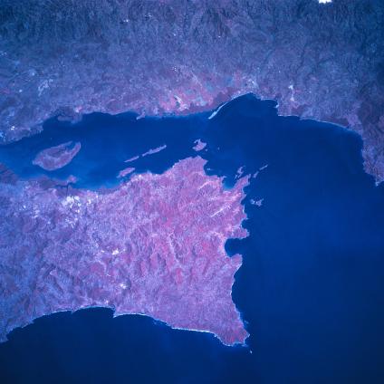
Nicoya Gulf, Peninsula, Costa Rica January 1997. The southern end of the mountainous Nicoya Peninsula extends southeasterly separating the waters of the Pacific Ocean from the Gulf of Nicoya. The color infrared image helps to document the numerous vegetated hills and valleys (red colors represent green plants) both on the peninsula as well as on the mainland. The deeper reds tend to show either dense stands of rainforest or in the coastal zone, they represent mangrove forests. The small estuary of the Rio Grande de Tarcoles is barely discernible near the upper right edge (southeast corner) of the image. Chira Island is the large island in the Gulf of Nicoya.
