Map of Belgium
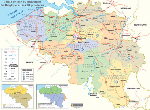
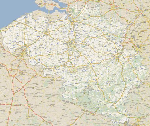
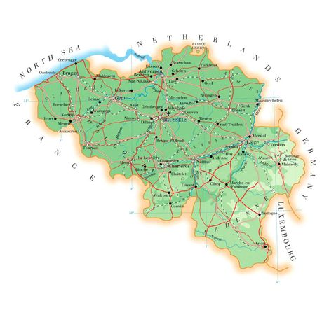
Map of Belgium, officially the Kingdom of Belgium, a country in Western Europe, bordered by France, the Netherlands, Germany, Luxembourg and the North Sea. Politically, it is a federal constitutional monarchy with a parliamentary regime. It is one of the six founding countries of the European Union and hosts, in its capital Brussels, the Council of the European Union, the European Commission, the Parliamentary Committees and six additional plenary sessions of the European Parliament, as well as other international organizations such as NATO. The country also hosts the Supreme Headquarters of the Allied Powers in Europe (SHAPE) in Mons. Belgium covers an area of 30,688 km with a population of 11,507,163 inhabitants on 1 January 2021, i.e. a density of 373.97 inhabitants/km².
Located halfway between Germanic Europe and Roman Europe, Belgium is home to two main linguistic groups: French-speakers, members of the French Community and Dutch-speakers, members of the Flemish Community. It also includes a German-speaking minority representing approximately 1% of the population and constituting the German-speaking Community of Belgium.
The administrative regions of Belgium are federated entities comprising: the Brussels-Capital Region in the center, an officially bilingual but overwhelmingly French-speaking area, the Dutch-speaking Flemish Region, in the north, and the French-speaking Walloon Region, in the south. It is in the east of the Walloon region that the German-speaking Community resides, in the cantons of Eupen and Malmedy, which border Germany.
Belgium's linguistic diversity and related political conflicts are reflected in its political history and in its complex system of government.
Historically, Belgium, the Kingdom of the Netherlands and the Grand Duchy of Luxembourg were known, in the 15th-17th centuries, under the name of the Netherlands, a region which corresponded to a territory slightly larger than the current Benelux, since the regions of Lille, Arras, Douai, Valenciennes, Montmédy, or even Thionville were part of it. The region which therefore covered part of Belgium as well as the north and east of France was described as "Belgica" in documents written in Latin, which was the name that had been taken over to designate the two Roman provinces between which the Gallia Belgica, conquered by Julius Caesar and created a Roman province by Augustus, was divided in 297 under Diocletian, one, the Belgica prima with Trier as its capital and the other, the Belgica secunda with Reims as its capital. From the end of the Middle Ages until the 17th century, the territory corresponding to Belgium was a prosperous commercial and cultural center and relatively cosmopolitan in its main cities. From the 16th century until the Belgian Revolution in 1830, when Belgium seceded from the Netherlands, the Belgian territory was the scene of many battles - mainly diplomatic - between different European powers, which leads it to be described as " battlefield of Europe", a reputation which was reinforced by the World Wars. Since its independence, Belgium took part in the industrial revolution, notably having been the second industrial power in the world for nearly a century and, during the course of the 20th century, it possessed several colonies in Africa. The second half of the 20th century was marked by tensions between the Flemings and the Walloons due to language differences and the unequal economic development of the two regions. This conflict led to several far-reaching reforms, including a transition from a unitary state to a federal state.


