|
|
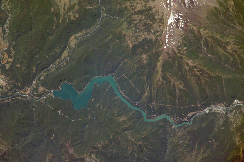
Satellite Image, Photo of Pangue Dam, Bíobío River, Chile
|

Pangue Dam, Bíobío River, Chile: Chile’s Bíobío River flows northwestward from the high Cordillera of the Andes to the Pacific Ocean near Concepción, about 450 km south of Santiago. The river is known globally for spectacular white-water rafting. This image shows a section of the river that skirts around Antuco volcano in the Andes, and features the Pangue Dam and reservoir filling a narrow, meandering segment of the Bíobío River valley. Completed in 1996, the dam is the first of six hydroelectric dams planned by ENDESA, a Chilean utility company. The future development of the Bíobío River is a point of intense debate among Chileans, and has been called Chile’s “defining environmental issue.” Over a million people use the resources of the river. Controversial issues include ecological damage from the reservoirs, impacts to native peoples, and international financing and accountability. One of the planned dams upstream from Pangue, the Ralco, would require relocation of indigenous peoples who still maintain traditional lifestyles and affect temperate rainforest. A Chilean activist, Juan Pablo Orrego, won the Goldman Environmental Prize in 1997 for his work to preserve the natural environment around the Bíobío. In May 2003, a Santiago court ruling allowed construction of the Ralco Dam to continue, but prohibited flooding the area occupied by the indigenous people. Upstream from the Pangue Reservoir (to the right in the image), the cleared areas associated with earth moving and construction of the Ralco Dam are visible. The straight white lines in cleared forest between the two dams probably represent power transmission lines.
