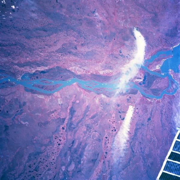
Río Paraná, Argentina/Paraguay Winter/Spring 1997 For geographic reference the Yacyretá-Apipé Dams are visible on the Río Paraná near the eastern edge of the picture (right margin). The Río Paraná is the border between Paraguay (top) and Argentina (bottom). In addition to the well-defined, natural floodplain of the Río Paraná (darker feature, mainly on the Paraguay side of the river), the entire scene shows a complex hydrologic pattern. Complicated and intricate drainage patterns can be observed on both sides of the river. It appears that the Río Paraná has repeatedly made significant course changes. South of the river, well defined, older drainage channels, primarily aligned in a northeast-southwest pattern, can be traced across this flat, swampy terrain. North of the Río Paraná in Paraguay the older drainage channels are aligned more east-west. Two large smoke plumes (white features-one originating in Paraguay, the other in Argentina) appear on the right side. A small section (solar array truss) of the Space Station Mir is visible in the lower right corner of the picture.
|
|